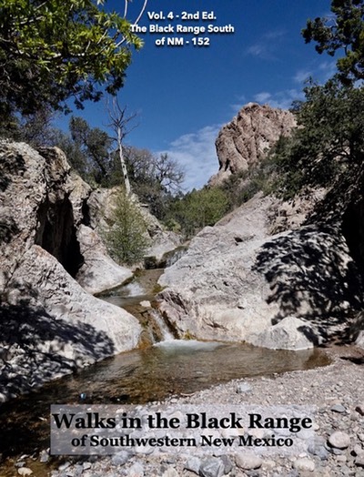
Under Construction
This page combines the Black Range travel material from the other pages of this site, eventually it will replace many of them. Here you will find our books on trails and various video projects from the Black Range. The focus is natural history, visit other pages for tourist information about the towns of the Black Range.
VIDEOS
Percha Box
- Percha Creek Side Canyon from County Road B023 to Percha Creek
- Percha Creek Side Canyon (a walk down the last one-third of the canyon listed above)
- Percha Creek Side Canyon C (a shorter version of the video listed directly above)
- Percha Creek Side Canyon B&W filter (the video listed directly above, mostly in black and white)
- Percha Creek Side Canyon (“A”)
- Micro-slot 360 degree video from Percha Creek Side Canyon (“A”)
- Video of Side Canyon “B”
- Drone Crash
- Aerial Video of Canyons A, B, and C.
- West of Wicks - Video of the Percha Narrows from the Percha-Wicks confluence west to the middle part of the Percha Box.
Auto Tours
Click here to see all of the road videos from the black range.
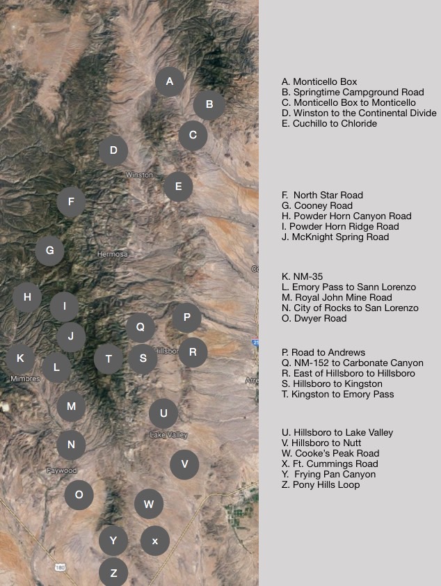
A. Monticello Box
- Road Video of the Monticello Box (this road is closed, after more than a century of public use)
- Narrative page: Black Range - The Northeast
- Video about Ojo Caliente - the spring which is sacred to the Warm Springs Apache
B. Springtime Canyon Road
- Springtime Campground Road
- Narrative page: Black Range - The Northeast
C. Monticello Box to Monticello
- Monticello Box to Monticello (The road through the box is closed, after more than a century of public use)
- Narrative page: Black Range - The Northeast
D. Winston to the Continental Divide
- Winston to the Continental Divide
- Narrative page: Black Range - The Northeast
E. Cuchillo to Chloride
- Cuchillo to Chloride
- Narrative page: Black Range - The Northeast
F. North Star Road
G. Cooney Road
H. Powder Horn Ridge Road
I. Powder Horn Ridge Road
J. McKnight Spring Road
K. NM-35
L. Emory Pass to San Lorenzo
M. Royal John Mine Road
N. City of Rocks to San Lorenzo (NM-61)
O. Dwyer Road
P. Andrews
Q. North Percha Road
R. East of Hillsboro
S. Hillsboro/Kingston
- Hillsboro to Kingston
- Kingston
- NM-152 (Hillsboro to Emory Pass)
- The Mines of Kingston…A Sketch of Kingston and Its Surroundings (1883)
- The English Work of the MEC in Hillsboro, Lake Valley, & Kingston
T. Kingston/Emory Pass
U. Hillsboro/Lake Valley
- The Hillsboro to Nutt Auto Tour Page (NM-27)
- Hillsboro to Lake Valley
- Tierra Blanca Road
- Upper Berenda Creek & Pierce Road
- Rock Stars of the Black Range- Volume 1
V. Lake Valley
- Hillsboro to Nutt
- Tales of Lake Valley
- Lake Valley Photo Gallery
- Lake Valley Aerial Video
- The English Work of the MEC in Hillsboro, Lake Valley, & Kingston
W. Cooke’s Peak
- Cooke’s Peak Road
- Photos of Cooke’s Townsite
- Reference: Cooke’s Peak - Pasaron Por Aqui, Couchman, 1990
- Reference: Annals of Old Fort Cummings, Parker, 1916
- Reference: The Mining Camps of Cookes Peak by Matthew Barbour
X. Ft. Cummings
- Ft. Cummings Road
- Ft. Cummings and Cooke’s Spring
- Photos of Ft. Cummings, Photos of Ft. Cummings, Photos of Cooke’s Spring, Photos of Cooke’s Spring
- Reference: Cooke’s Peak - Pasaron Por Aqui, Couchman, 1990
- Reference: Annals of Old Fort Cummings, Parker, 1916
- Ft. Cummings Aerial Video
Y. Frying Pan Canyon
Z. Pony Hills